
Computing the Concave Hull of a set of points in 2D
Link to Repository See hulls.py and test_ConcaveHull.py
Project Description
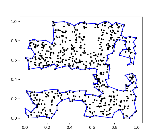
Here I have modified João Paulo Figueira’s python implementation of hulls.py so that it takes ordinary 2D Cartesian coordinates as input, and returns a concave hull using the minimum possible value of k, the only parameter required by this algorithm [1]. The original code [2] was designed to work with latitude-longitude data, and uses the appropriate distance metrics. My code uses the standard euclidean distance metric and increases k by 1 until a concave hull is found which encloses all points and does not self-intersect.
References
- Original paper explaining the algorithm: Moreira, A. and Santos, M.Y., 2007, Concave Hull: A K-nearest neighbors approach for the computation of the region occupied by a set of points https://towardsdatascience.com/the-concave-hull-c649795c0f0f
- João Paulo Figueira’s concave hull repository for Geospatial data https://github.com/joaofig/uk-accidents
- João Paulo Figueira’s towardsdatascience article explaining code https://towardsdatascience.com/the-concave-hull-c649795c0f0f